The major events this week are the:
Halves presentation
Main client looking at our prototype for the first time
Playtesting session
Halves presentation:
In our halves presentation we spoke about the research, exploration, production, playtesting, demovideo and schedule
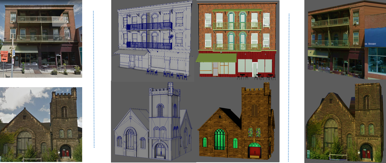
In our research, we spoke on our site visit, the books we referred to, the sites and the previous work we looked into. Then we spoke on how we moved to the production phase from our research phase after scoping down our project with the help of the proposal we gave our clients.
We divided our project presentation into 2 phases:
1phase- exploration
2phase- iteration
In exploration, we spoke on all the programming, art, data exploration process and in iterations, we spoke on how we worked on different iterations of UI, prototype and art style.
We also spoke about our demo video and all the features-functionality, art style, environment.
Main Client from the City of Pittsburgh, planning department had come down for our halves presentation and gave us some extremely good feedback later on.
Feedback on our halves presentation:
From instructors:
-They appreciated the progress we made since quarters
-They think we dressed well, handled questions well and the demo video was appreciated
From clients:
-They really are impressed by the work and the progress that we are making
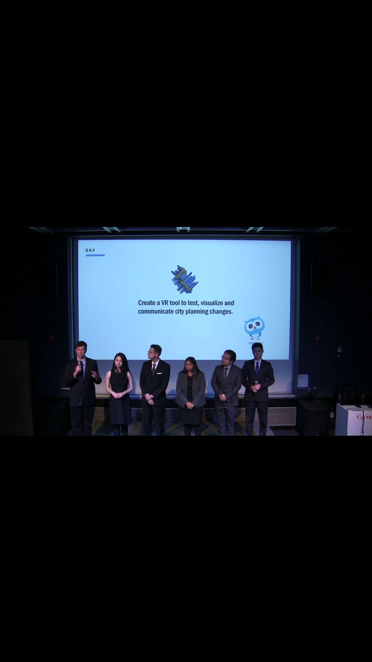
Here is a photo from our halves presentation:
Playtesting session:
We conducted a playtesting session by asking people to sign up for it. Then we came up with scenes/tasks (user case stories) for them to do while in the prototype.
You are an urban design student tasked with changing the height of a local business from its current height to 10 stories. After you’ve adjusted the height, you want to see how the building’s shadow affects the area at dawn.
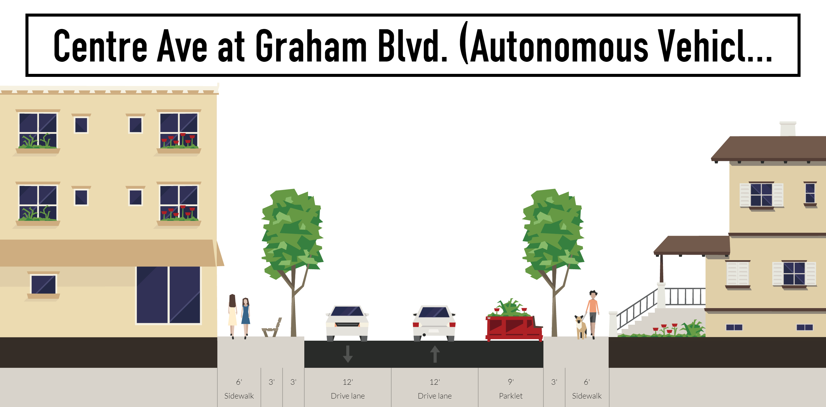
You are an urban design student tasked with previewing what Centre Avenue would look like with bike lanes. After you’ve made adjustments to the road, you’d like to see how the area looks in the rain.
You are an urban design student tasked with changing the height of a local house from its current height to four stories. After you’ve adjusted the height, you want to see how the building’s shadow affects the area at sunset.
You are an urban design student tasked with previewing what Centre Avenue would look like with bike lanes. After you’ve made adjustments to the road, you’d like to see how busy the roads are in the afternoon.
You are an urban design student tasked with changing the height of a local business from its current height to 10 stories. After you’ve made adjustments to the business, you’d like to see how busy the roads are in the afternoon.
Then we also had a questionnaire after they completed their tasks.
In the questionnaire we had asked their opinion and also asked them to rate our UI and prototype on scale of 5. The least rating we got was 4/5.
We also came up with a playtesting schedule:
Week 9 Thursday, October 26th
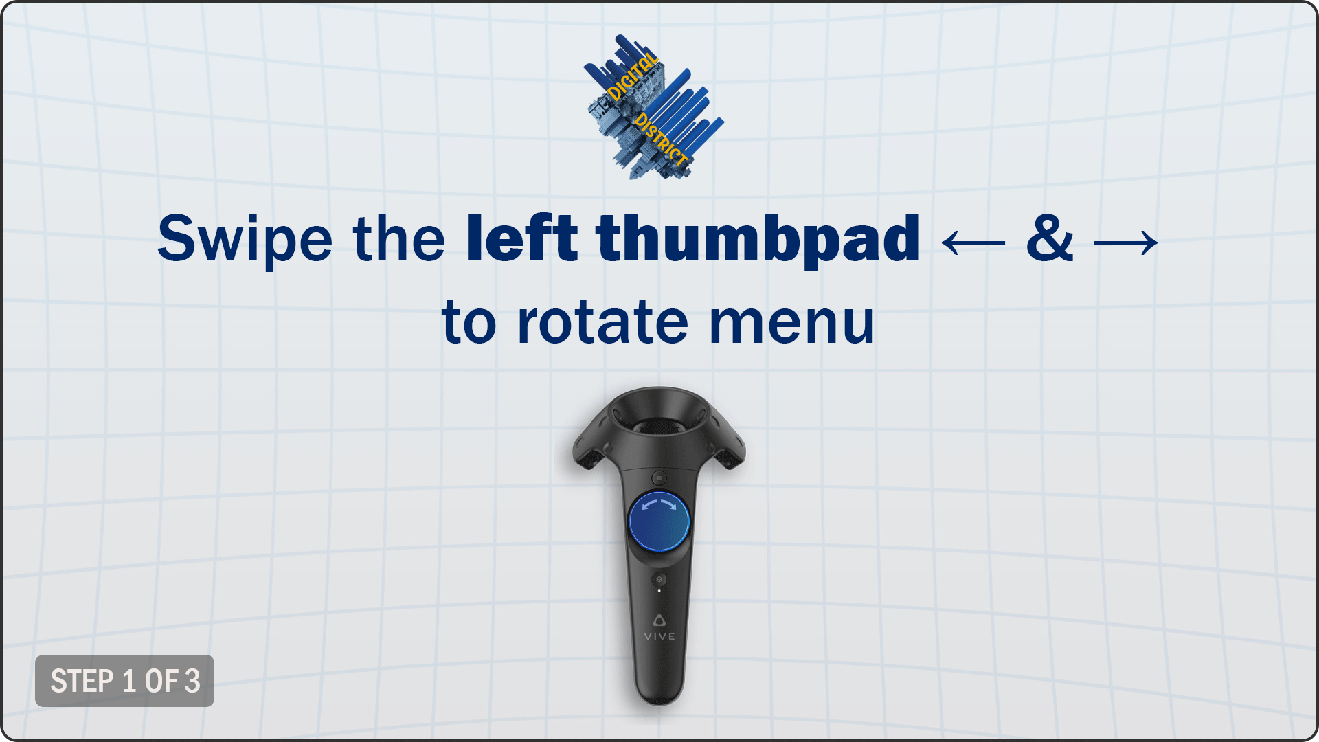
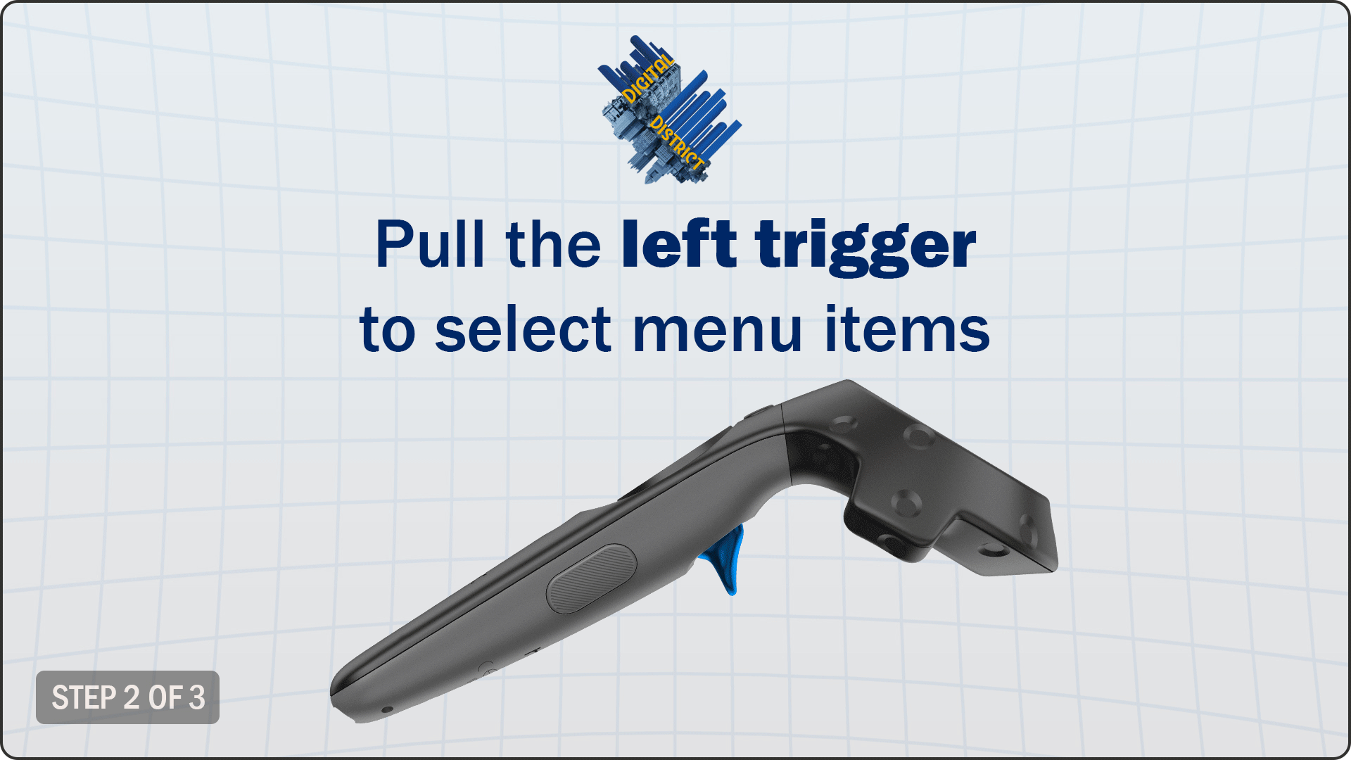
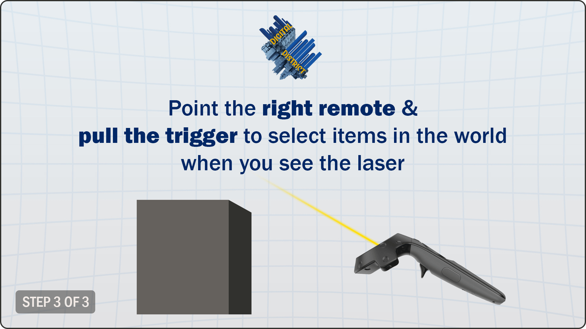
- Playtest Interface
- How easy it is to navigate menus
- Scale of 1-5 how intuitive is the menu, how it looks
- Ease of selecting buildings
- Could you tell when you selected the building, did you select the building you wanted,
- Guest response to sound effects
- How easy it is to navigate menus
- Immersiveness of space
- Proper scale
- Response to people walking along streets
- Tutorial paper playtest
Week 10 Wednesday, November 1st
- Interface
- Guest response to adjusting building height
- Response to visual effects and sound effects
- Test 3D icons of road types
- Guest response to adjusting building height
- Playtest first iteration of birds eye view mode
- Are they close enough to buildings to make selections?
- Can they move around and view the whole area?
- Are the teleportation locations easy to select and understand?
- Teleportation-moving around an intersection
- Is there any motion sickness?
- Does the guest understand that they’ve moved to another area?
- After they’ve teleported do they feel like they are correctly oriented in the space?
Week 12 Wednesday, November 15th
- Playtest changes from last playtest
- Zoning Features
- How easy is it to change zoning types?
- Are color codes easy to identify?
Below is the video of our main client (Ray Gastil, Director of City of Pittsburgh, Planning Department) Playtesting our product